Center for Occupational and Environmental Health
UC Davis Logo
UC Davis Logo
Center for Occupational and Environmental Health | Building Safer, Healthier Workplaces & Communities Across California

Center for Occupational and Environmental Health

Building Safer, Healthier Workplaces & Communities Across California
  • UC Berkeley COEH
  • UC Los Angeles COEH
  • UC Irvine COEH
  • UC San Francisco COEH

Main navigation (extended config)

  • Home
  • About Us
    • Our Mission
    • Our History
    • Our People
  • Research
    • Data Resources
  • Education Programs
  • Events
  • Blog
  • Contact Us
UC Davis students at computers in a mapping class

Data Resources

Breadcrumb
  1. Center for Occupational and Environmental Health
  2. Research
  3. Data Resources

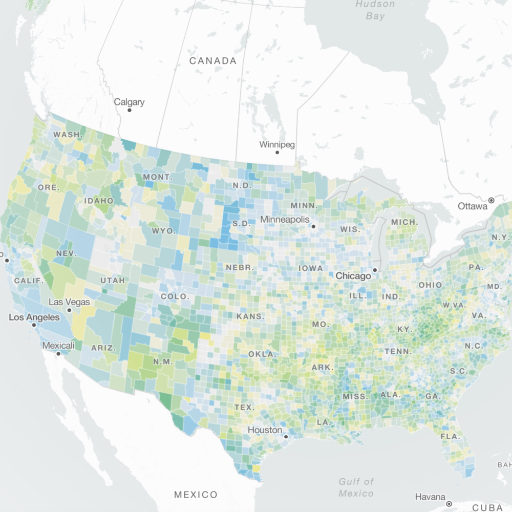
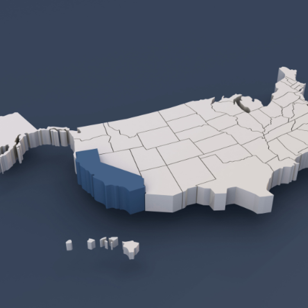
Mapping for Public Health Data Tools for Healthy Communities

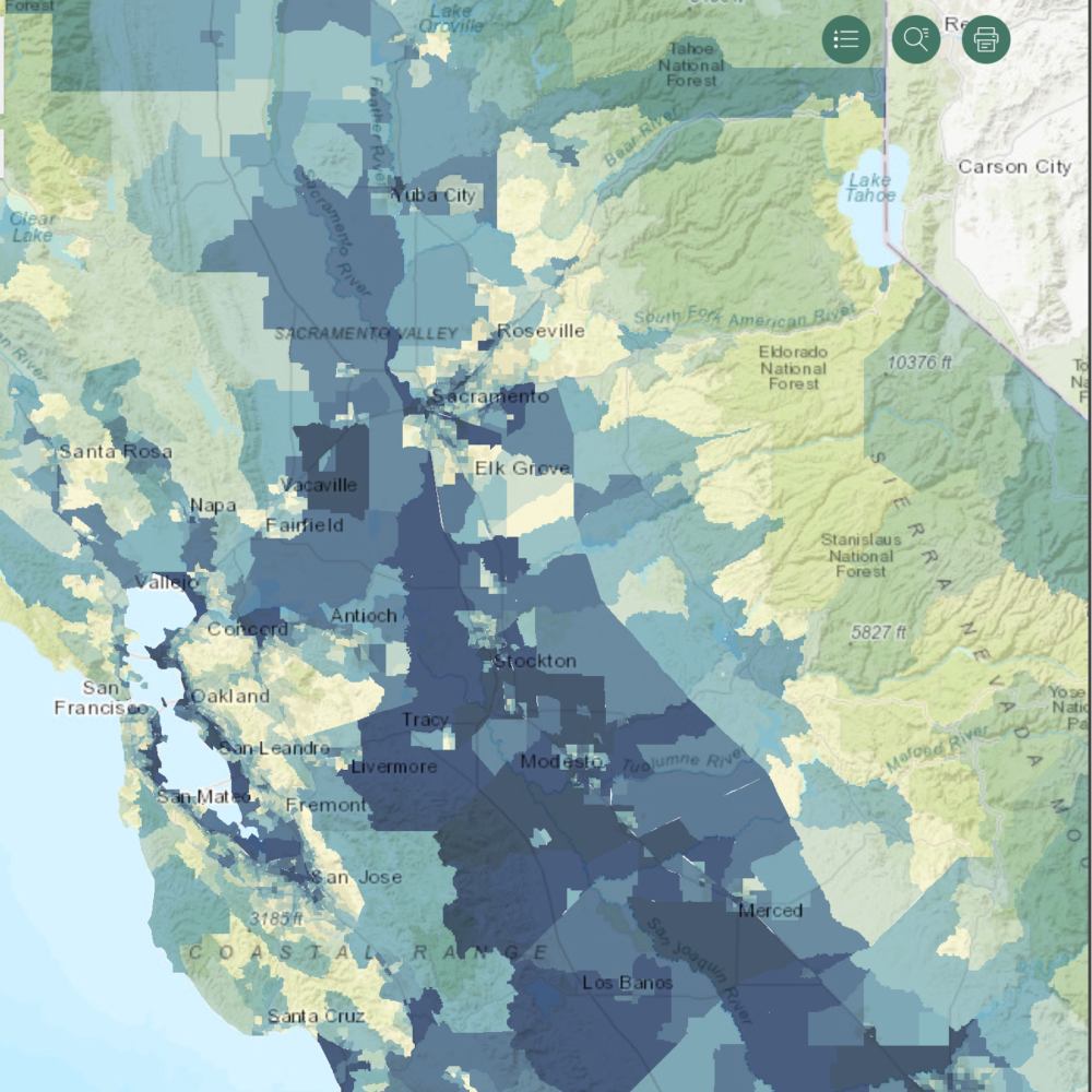
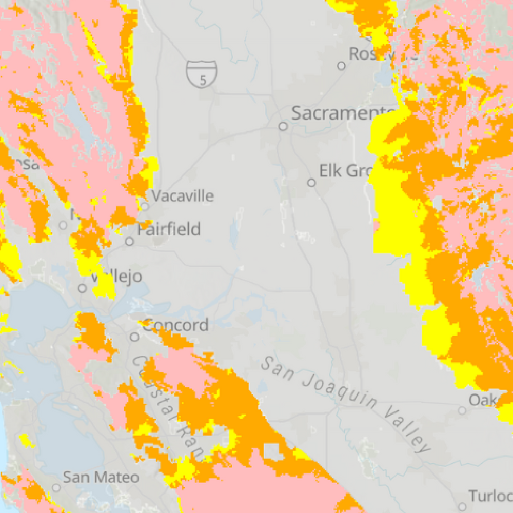
Understanding the connections between environment, place, and health is essential for creating healthier communities. This page highlights powerful mapping tools that visualize key public health indicators—from pollution burden and cancer rates to access to green space and rural health disparities. Explore resources like UCSF’s Health Atlas, the Healthy Places Index, MIT’s Treepedia, CalEnviroScreen, the Rural Health Mapping Tool, and the National Cancer Institute’s State Cancer Profiles, to name just a few. These tools support data-driven decision-making for researchers, policymakers, and advocates working to advance health equity and environmental justice across California and beyond. Dive in to see what the data reveals.

CalEnviroScreen (OEHHA)

Maps pollution burden and environmental risk factors in California communities. Identifies areas most affected by environmental hazards.

Cal Enviro Screen Map of Northern California

County Health Rankings & Roadmaps (UW)

Highlights health disparities across communities and promotes policies to advance equity and help all people thrive.

Map with Fresno County highlighted

Dartmouth Atlas (DC)

Uses Medicare and Medicaid data to reveal major geographic variations in U.S. medical resource use and healthcare practices.

United States

Demographic and Health Surveys (DHSP)

Gathers population and health data in over 90 countries, using GIS to link survey results with geographic and environmental factors for deeper analysis and planning.

Different colored people figurines

Fire Hazard Severity Map (Cal Fire)

Classifies wildfire hazard—not risk—based on long-term physical conditions like vegetation, terrain, weather, and fire behavior.

Cal Fire Wildfire Severity Map

GIS Open Data (CDPH)

Provides GIS data from the California Department of Public Health.

Palm Trees at Sunset in California

GIS Portal for Cancer Research (NCI)

Offers mapping tools and data on cancer rates, risk factors, and policies to support research and cancer control efforts across the US.

Cancer cells

Health Atlas (UCSF)

Explores neighborhood-level data to see how it relates at the population level. Captures social determinants of health and relevant health outcomes.

US health data points from UCSF's Health Atlas

Healthy Places Index (PHA)

Visualizes community conditions that shape health, like housing, education, and access to care. A key tool for health equity and policy planning in California.

Aerial view of neighborhood greenspace

Institute for Health Metrics and Evaluation (UW)

Produces data-driven metrics, including the Global Burden of Disease, to inform health policy worldwide.

Health metrics on a computer screen

PLACES: Local Data for Better Health (CDC)

Provides health and health-related data using small-area estimation for counties, incorporated and census designated places, census tracts, and ZIP Code Tabulation Areas (ZCTAs) across the United States.

Urban and rural housing

Rural Health Map (NORC)

Maps the relationship between COVID-19 vaccination rates and other health outcomes across urban and rural communities in the US. Supports policy and planning in underserved regions.

Cow

SEER*Stat (NCI)

Offers user-friendly software for analyzing cancer databases and generating statistics to study cancer’s impact on populations.

Figurines of people milling about

Small Area Estimates for Cancer-Related Measures (NCI)

Produces model-based small area estimates on key health behaviors by integrating survey and census data using advanced statistical methods.

United States in White with California in blue

State Cancer Profiles (NCI)

Offers state and county-level cancer statistics, including incidence, mortality, and screening. Supports cancer control planning, policy, and surveillance.

Leukemia cells with Epstein Barr virus

Treepedia (MIT)

Measures and compares urban tree coverage around the world. Promotes green infrastructure and environmental quality in city planning.

Sacramento Capitol

WONDER: Wide-ranging Online Data for Epidemiologic Research (CDC)

Provides public access to a wide range of health and environmental data at multiple geographic levels.

Crowd of people walking in crosswalk
Aggie Pride Graphic with cow
Spatial data concept

Free courses From Ersi Academy

Esri Academy supports GIS practitioners, non-GIS professionals, and anyone else wanting to use the ArcGIS platform to enhance their projects with geographic context that can help lead to better decision-making. The Academy offers over 100 free courses.
Learn more
Two people discussing studies while looking at notes

Events & Calendars

Need to keep track of holidays, deadlines, or department events? Stay informed with these UC Davis resources for prospective and current students interested in occupational and environmental health. Find key dates for UC Davis graduate programs, Public Health Sciences, Vet Med, Med School, and more—right here in one place.
Stay in the loop
Aggie Pride Graphic with cow

Aggiefeed

About Us
Research
Blog
Follow Us
UC Davis footer logo

University of California, Davis, One Shields Avenue, Davis, CA 95616 | 530-752-1011

  • Questions or comments?
  • Privacy & Accessibility
  • Principles of Community
  • University of California
  • Sitemap
  • Last update: August 12, 2025

Copyright © The Regents of the University of California, Davis campus. All rights reserved.

This site is officially grown in SiteFarm.